Content Category Imaging and Sensors
|
UAS Inspects, Creates 3D Model of the Largest Mosque in Turkey
|
on December 08, 2014 by Unmanned-Aerial.com 
|
|
Aibotix, a German developer and manufacturer of multicopters for applications in the industrial sector, has teamed up with several companies to inspect what it says is the largest mosque in Turkey. Along with SISTEM A.S. (a Turkish distributor of Leica Geosystems) and NRG Engineering (a project management service provider), Aibotix created a detailed 3D model of the Sabanci Merkez Mosque More
|
|
ING Robotic Aviation Goes with Photogrammetry Software from SimActive
|
|
on November 25, 2014 by Unmanned-Aerial.com
|
|
ING Robotic Aviation, a Canadian provider of robotic aircraft solutions, has elected to use the Correlator3D from SimActive, a developer of photogrammetry software. Along with using SimActive's software for internal post-processing requirements, ING Robotic Aviation is recommending it as the de-facto software with its robotic aircraft systems. “We are extremely impressed with the maturity of the product compared with the More
|
|
Parrot Invests in MicaSense Drone-Based Sensing Solutions
|
|
on November 24, 2014 by Unmanned-Aerial.com
|
|
MicaSense, a developer of technologies that enhance the capabilities of robotic platforms, has raised $2 million in Series A funding from Paris-headquartered Parrot. MicaSense, which operates from Seattle and Simi Valley, Calif., says it delivers a fully integrated hardware solution for agricultural remote sensing from any unmanned aerial platform, tightly coupled with cloud-based analytics to provide crop health information to More
|
|
Pix4D Creates Mapping App for DJI Phantom Users
|
|
on November 18, 2014 by Unmanned-Aerial.com
|
|
Making use of DJI's new software development kit (SDK), Switzerland-based Pix4D has developed what it calls the first mapping app to turn drones into an autonomous mapping and measuring tool to create 2D maps and 3D models. The company says its Pix4Dmapper is already used by DJI customers for surveying and measuring projects. DJI’s SDK allows Pix4D to offer a More
|
|
Trimble Rolls Out Enhancements for Aerial Imaging Solution
|
|
on November 03, 2014 by Unmanned-Aerial.com
|
|
Trimble, a technology company focused on applications requiring position or location, has added enhancements to its Trimble Access Aerial Imaging 2.0 application to make for faster planning and greater performance of unmanned aerial systems (UAS) flights. Part of the Trimble Access field software suite of applications, the Aerial Imaging application is a software tool used with the Trimble Tablet Rugged More
|
|
Hawaii Researchers Map Active Lava Flow for Emergency Responders
|
|
on October 31, 2014 by Unmanned-Aerial.com
|
|
Researchers from the University of Hawaii at Hilo (UH Hilo) have used an unmanned aerial vehicle (UAV) to successfully map the active flow front of the Kilauea lava flow on Hawaii Island. On Oct. 22, in a collaborative partnership with Hawaii County Civil Defense and the U.S. Geological Survey Hawaiian Volcano Observatory, the flight team from the UH Hilo Spatial More
|
|
Headwall Photonics and Leica Geosystems Enter New Partnership
|
|
on October 30, 2014 by Unmanned-Aerial.com
|
|
Leica Geosystems and Headwall Photonics have established a partnership agreement whereby Leica Geosystems will resell and integrate Headwall's line of hyperspectral imaging sensors into its airborne product portfolio. This will include Headwall's new Nano-Hyperspec sensor for small, lightweight unmanned aerial systems (UAS) deployment. Leica Geosystems, a Switzerland-based provider of geospatial data acquisition and mapping products, selected Headwall’s hyperspectral imaging sensors More
|
|
PrecisionHawk, Benson Hill Biosystems Team Up for Crop Analysis
|
|
on October 30, 2014 by Unmanned-Aerial.com
|
|
Agricultural biotechnology company Benson Hill Biosystems, The Photosynthesis Company, is partnering with PrecisionHawk to apply aerial imaging for the analysis of crop photosynthesis in the field and prediction of crop performance and yield. "Increased crop yield is the most important trait in modern breeding and agricultural biotechnology," says Tom Brutnell, chief scientific officer of Benson Hill Biosystems. “Today, however, it More
|
|
AutonomouStuff Becomes Distributor of YellowScan LIDAR
|
|
on October 30, 2014 by Unmanned-Aerial.com
|
|
AutonomouStuff, a Morton, Ill.-headquartered provider of components and services for autonomous systems, has entered into a sales, distribution and support contract with YellowScan L'Avion Jaune. The partnership allows AutonomouStuff to provide its customers with the YellowScan unmanned aerial vehicle (UAV) LIDAR scanning system - what AutonomouStuff says is the world's lightest stand-alone surveying solution for UAVs and other ultra-light aircraft. More
|
|
Aerialtronics Rolls Out the Altura Nucleo+ Sensor Box
|
|
on October 22, 2014 by Unmanned-Aerial.com
|
|
Netherlands-based unmanned aerial systems (UAS) manufacturer Aerialtronics has introduced the Altura Nucleo+, a fully digital version of the company's Dupla Vista sensor box. The key advantage to the Nucleo+, Aerialtronics says, is the access to two sensors at the same time - making remote-controlled switching between the two sensors possible. The technology is particularly useful for operators who require multiple More
|
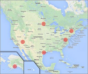
FAA UAS Test Sites
Follow Us
Popular
An unmanned aerial system (UAS) is responsible for helping put out a fire at a peanut plant in Cordele, Ga. CNHI News reports that [...]
Read More
A team from Carnegie Mellon University's Robotics Institute and Sensible Machines has developed a small unmanned aerial system designed for assisting fire-fighting inside navy [...]
Read More
As part of the show's "Game of Drones" series, ABC's Good Morning America (GMA) brought in an unmanned aerial vehicle (UAV) to deliver a [...]
Read More


Social